Thursday, 30 September 2010

Pavey Ark via Jack's Rake (November 2009)

I started this walk around 10am from the pay and display car park next to the Stickle Barn near the New Dungeon Gill Hotel.  It was a cold but sunny November morning in the picturesque valley of Great Langdale.  There was a great view of the lower fells on either side of Stickle Gill which hardly get mentioned on the OS Explorer Map.  They looked like interesting fells in their own right, but are dramatically over shadowed by the Langdale Pikes.  From the car park the Pikes are largely obscured by the steep sides of the valley.

I set off up the footpath which went through a wooded area beside Stickle Gill, and followed the path by the steam crossing to the eastern bank a little further up.  The slopes leading up to Stickle Tarn looked a glorious golden brown under a shinning sun in the cold crisp air.  Above me to my left was was Pike How and to my right were the rocks of  Langdale's Tarn Crag. As I continued up the path it began to get rocky and involved some light scrambling.  I decided to cross back over the boulder strewn stream, which was flowing deep and fast today.  It seemed much more difficult on this occassion, compared to my last crossing at the same point two years earlier.

As I completed the last section of the climb, the grand site of Pavey Ark came into view.


As the ground levelled out Stickle Tarn also came into view along with the wall that runs along the southern edge.  I decided to take a rest after the steep ascent, and went to sit on the wall and take in one of the most impressive views in the Lake District.


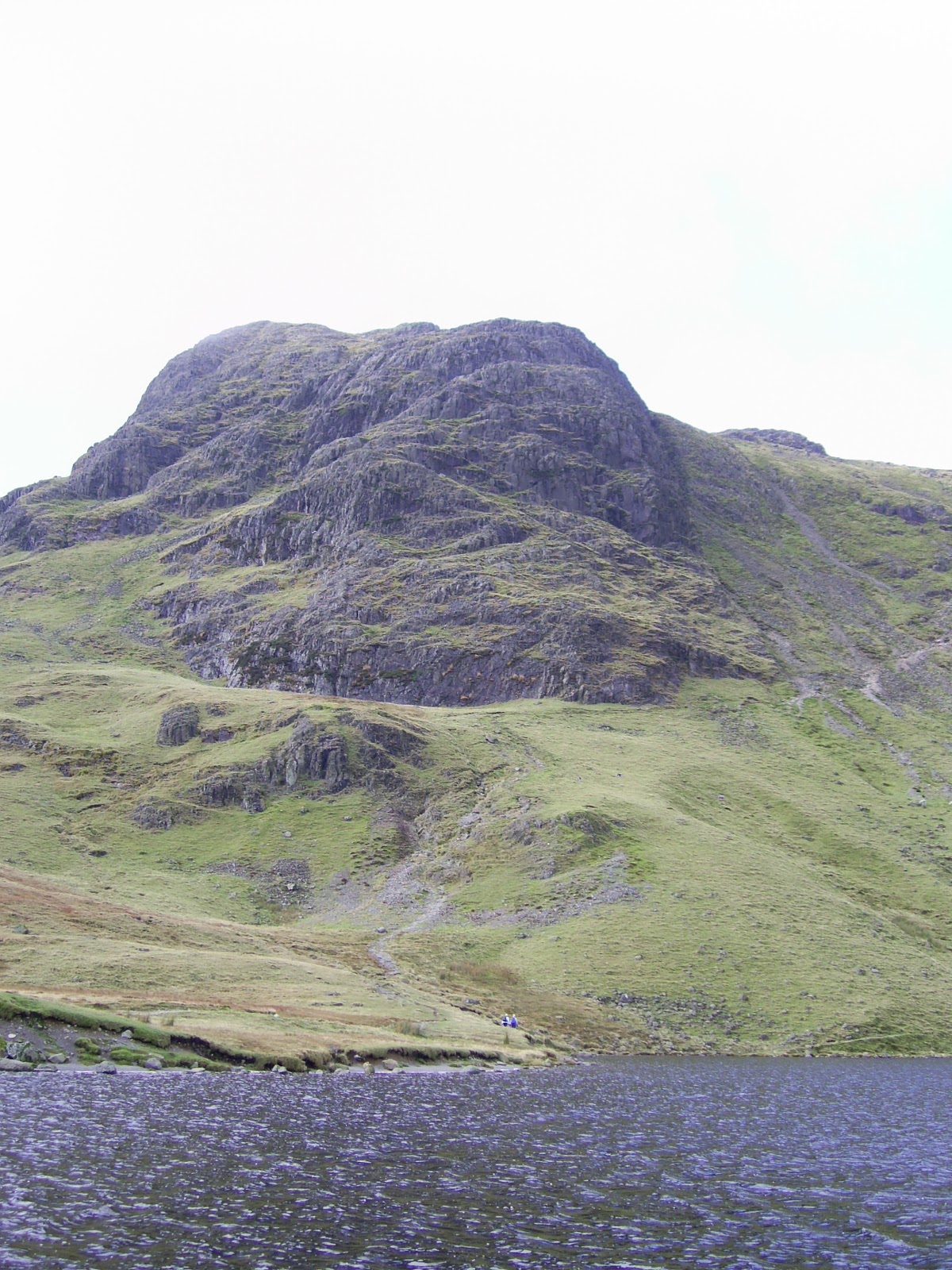
Straight ahead of me was the massive cliff face of Pavey Ark across Stickle Tarn, and to my left was the eastern shoulder of Harrison Stickle, the highest of the Langdale Pikes.  As I sat there, I surveyed the diagonal line of Jack's Rake, starting at the  lower right hand side of the Pavey Ark's cliff, going upwards to the left, and ending at the small pinacle.  It looked a somewhat formidable sight, and I couldn't help feeling a slight sense of apprehension as I viewed the spectacular rock face.  In less that thirty minutes I would be starting this ascent myself.

I made my way around the south-western corner of the tarn, turning off the main path which went up to Harrison Stickle, and followed the bank of the water.  As I went on, the dark cliffs of Pavey Ark loomed up overhead across on my left.  I veered away from the side of the water and started to climb across the large boulders and scree to the start of Jacks Rake.  It seemed rather dark, damp, and cold as I got up close.  

The start of Jack's Rake.  Notice the small group just setting out centre right.
There is also a lone scrambler part way up.
 I eventually made it to the start of the Rake.  I started the initial section which involved a reasonable easy scramble inside a groove in the rock which was about a meter wide.  The rock wall of Pavey Ark was too my right, whilst to my left there was a low natural parapet with some vegetation growing on it.  It was almost like going up a staircase.  Things soon started to get more difficult though.  When I first started I could see a group higher up the rake just before the "path" turned round a curve in the rock and went out of sight.  They seemed to be hardly moving, and I thought I would soon catch them up.  This did not happen though.  As I approached this steeper section of the Rake, I found it technically challenging, with suitable foot and hand holes difficult to find as I made my way upwards.  Some which I was forced to used seemed to be barely cracks in the rock which I normally would not attempt to use, but this was all there was, and once I had started to climb it was easier to continue up than to retreat back down.  I had certainly let myself in for something much more difficult than what I had imagined. It was slow going. I gradually made my way upwards,with each movement carefully thought out and tested in advance, until I made it to a flat ledge above an Ash tree growing out of the cliff below.

This photo was taken at the top of the first section of the Rake.
It is a bit deceptive in as much as it doesn't give a sense of the steep climb
required to get to this point.  The near vertical section of climb
is hidden below the ledge left of the Ash tree.
On the right there is a vertical drop.

This had been the steepest sustained section of the rake.  Further along there were more level sections, some along narrow exposed ledges above steep grass slopes that lead down to vertical drops down the crag face.  There were still many shorter sections of steep climb which I found rather challenging.  One of these was, for me, particularly scary.  After traversing one of the level sections of ledge, there was a steep climb that seemed to be just above a vertical drop down to the scree above the tarn.  This seemed to be the most exposed section of the rake. I really had to force myself to do this part. I was at this point acutely aware of how high I was on the rock face, and it did feel much more like rock climbing than scrambling. 

After negotiating a number of other difficult (although not quite as traumatic) sections, I came round a bend in the rock, and saw a wide rock gully running down the face of the crag, relatively easy to scramble across.  I knew at this point that this was Great Gully, and this marked the final section of the Rake.  I could see the Pinnacle above, a bit further ahead. 


 I read in Wainwright that I needed to head for the depression just to its right. To get there I needed to pick my way though sections of rock and vegetation.  Finding a way through was more difficult than the photograph above suggests.  Once I had crossed the gully and got up close to the rocks, it wasn't obvious which climbs led to ledges from where I could continue climbing safely.  At one  point I climbed up onto a ledge adjacent to a huge slab of slanting rock.  Normally it could have been crossed, but on this occasion it was  too wet and slippy to grip.  In order to continue it was necessary to climb back down to the lower ledge and use a different route up the rock.  Once I had done this I had reached the side of the pinnacle where there was flat rock.  This was the end of Jacks Rake.  I felt a deep sense of relief to have made it.

From here I made my way over the last sections of rock to the summit of Pavey Ark where I sat down to take in the incredible views.


Looking across from Pavey Ark summit to Harrison Stickle.

Looking from Pavey Ark summit across the ridge leading to Pike o' Blisco to the Coniston Fells.  The rocky slope on the right is the east shoulder of Harrison Stickle.

I have to admit the ascent of Jacks Rake had been a difficult and traumatic climb for me.  It had tested my scrambling abilities even though I have had previous experience of rock climbing. It was, however, a fantastic experience, and one which I would very much like to do again.  It wasn't until the next day when I truely realised this.  But as I sat there on the summit of Pavey Ark, I did at that moment feel emotionally exhausted, despite the fantastic views, which I still managed to appreciate.  

I finished the walk by making my way along the path to Harrison Stickle where I spent some time on the summit taking in the views across the Great Langdale Valley.  On the descent I took the path above the steep ravine of Dungeon Ghyll, another spectacular sight, before following the path down the steep slope to Pike Howe, and back to the car park at the Stickle Barn.

Friday, 24 September 2010

Blencathra via Sharp Edge

This was a walk that I did back on a rainy day in October 2009. I had originally planned on doing the tourist route to the summit of Skiddaw, but somehow could not find the enthusiasm to try this particular walk on this occasion; I wanted something a bit more exciting. As I was lying in bed the evening before I had the idea to try Blencathra's Sharp Edge. Now I felt completely gripped by the idea!

I could tell the conditions were not going to be ideal for this as I drove past the Howgills on the M6. The sky was a mixture of gray and white cloud, the windscreen wipers were more on than off; but more than anything else it was extremely windy. I arrived shortly after 10am and parked in a layby on the A66 at Scales. The rain came down as I walked up the narrow tree lined lane that led to the beginning of the path.

I followed the path beside Mousthwaite Beck, which started to climb steeply as it rose up into the comb. At the top there was a wet grassy shelf between Scales Fell and Souther Fell. It was at this point that the Saddle of Blencathra came into view, just visible below the white cloud blowing across the plateau. However the thing that really grabbed my attention at that point was the dramatic drop at the east end of the plateau, where Foul Crag joined with with the knife edge ridge of Sharp Edge.  From this vantage point the route looked almost impossible for a walker to accomplish.


As I made my way towards the end of the shelf to join the path to Sharp Edge, the clouds cleared for a time, and I got a clear view of the dramatic scenery.


Turning right at the end of the shelf the path skirted the lower slopes of Scales Fell above the river Glenderamackin. Soon the path began the steep climb beside Scales Beck where it flowed down from the Tarn above. Sharp Edge was getting closer with every step. As the path levelled out at the top of the climb,  Scales Tarn stretched out before me below the towering face of Sharp Edge and the rock wall below Blenchathra's Saddle.


I could really feel the wind as I stood beside the tarn looking up at the ridge.  I was wondering at this point whether I should attempt Sharp Edge under these conditions.  In the end I decided to continue along the path leading up to the start of the ridge and see what it was like up there.  As I climbed the slope the wind nearly blew me off my feet on a couple of occasions, and made walking quite difficult.  In the end I reached the rocks that marked the start of the Sharp Edge traverse, and to my surprise the wind didn't seem quite as bad there.


I remember taking off my my waterproof so it wouldn't flap around before climbing  up onto the first section of the ridge.  The rocks were wet which made them somewhat slippy and required great care negotiating them.  Once I had got a little further along the ridge, my feelings of apprehension were replaced by that of exhilaration.  Whilst still taking the utmost care, I was really enjoying being there up on the ridge.  The view down to the tarn was spectacular.


I stopped to take some photographs, and as it started to rain sideways across the ridge, the top of Blencathra's saddle was no longer visible.   Further along Sharp Edge, the ridge became more exposed as I got closer to the climb up Foul Crag at the end.  The rain seemed to be getting worse, although Blencathra's plateau seemed to offer protection from the wind.


Soon I had reached the end of the ridge but there was still the steep slippy climb up Foul Crag to reach the saddle.


It was a hard climb up the crag involving a great deal of scrambling.  The section of the climb in the photo above turned out to be too slippy for my boots to grip, so I had to retreat and go up another way just to the right of this shot.  When I eventually finished the climb, I was up in the clouds and rain.  The ridge below was no longer visible, and unfortunately there was no views to be seen as I walked across the saddle to the summit of Blencathra.  I met two small groups of people at the summit who I talked with for a short time before heading down the zig zag path towards Scales Fell.  

As I decended, I suddenly came out of the cloud and I could see down to valley level once again.  I took the path down to Doddick Fell where the ridge of joined Scales Fell.  It was a steep slippy descent before leveling out.  There was a fantastic view down into Doddick Gill on the right hand side of the ridge.  There was also a spectacular view back up to Blencathra above the Gill, although the top of the summit was still in cloud.


After the the ridge flattened out, it widened into a broad dome as it sloped down to the valley floor.  The path then skirted the bottom of the slope above the fields of Doddick Farm.  It had been an enjoyable and exhilarating walk, in spite of, and partly because, of the weather conditions.  I was feeling quite tired by this point and looking forward to getting back to my car at Scales.  However, there was, to my suprise, one last section of rock to negotiate.  Just before the path crossed the stream of Scaley Beck, it droped down over some steep rocks which were saturated with the rain.  I droped down and crossed the Beck before climbing the smaller rock on the other side. This required some difficult scrambling, quite unexpected at this stage of the walk!  Having passed this section, I followed the path back to the small hamlet of Scales nestled under the slopes of Scales Fell. I arrived back at the car around 2.30 in the afternoon.  It had been a great walk.


Wednesday, 26 August 2009

Tarn Crag and Sergeant Man from Grasmere

After a long drive up the M6 motorway, I eventually arrived in Grasmere at around 11 am. The sun was shinning as I sat outside a tea shop to have a drink and study the route I was going to take. I was still undecided at how I was going to get from Easedale Tarn to Tarn Crag as there didn't seem to be an obvious path.

After I finished my brew I set off up the narrow road towards Easedale. Just before taking the path to Easedale Tarn I stopped to take some photographs of Helm Crag which seemed to be towering up in front of me at that point.


I crossed the footbridge over a fast flowing stream under the shade of some trees. The path then opened up as I passed through farm fields before starting to climb beside Sourmilk Gill.

Sour Milk Gill

The path wound it way up throught the braken slopes over rocky sections, and at one point passed close to the waterfall with its foaming white water. I pressed on up to the tarn where I got a fantastic view of Tarn Crag.

Tarn Crag

I crossed the stream where it flowed out of the tarn and made my way up the slopes on the other side. It was hard going through the bracken, but I eventually got to the top of the ridge just before the final ascent to tarn crag.


I headed for the summit on the left to begin with. I remember reading in Wainwrights Central Fells that this offered a good view down to the tarn - which it did.

Easedale Tarn

After taking the photo's of the summit cairn and view down to the Easedale Tarn, I made my way over to main summit where I sat down to have some lunch. The views from here were amazing. In one direction I was looking across Far Easedale, over the Gibbson Knott ridge between Helm Crag and Calf Crag. I could see Steel Fell behind, and the Helvellyn range behind that. The photograph that I took does not capture the full openess of the view which I found inspiring. In the other direction I was looking across Codale Tarn and over the ridge to Pavey Ark and the Langdale Pikes. Another great view to see.


Helm CragFar Easedale Ridge

There were also some great views of the Vale of Grasmere and Lake Windermere.

View of Windermer in distanceVale of Grasmere

From Tarn Crag I head up towards Codale Head and then on to Sergeant Man.

Harrison Stickle

This is the view from the summit of Sergeant Man looking towards Pavey Ark and Harrison Stickle.


I could also see over towards Great Gable.

Great Gable in distance

After stopping a while at Sergeant Man summit, I made my way down to Easedale Tarn on the direct path; then back to Grasmere.

Grasmere Village

Saturday, 11 July 2009

High Street

This was my first Lake District Walk of 2008. Apart from a short walk to Helm Crag the previous year, it was also the first walk that I did since Scafell Pike in 2006. After a pleasant drive over the Kirkstone Pass, I dropped down into the Patterdale Valley and parked in a layby close to Brothers Water.

I walked a short distance back along the main road before turning up a narrow lane which headed up to the small village of Hartsop. After crossing the stream I headed into the Pasture Beck valley between Hartsop Dodd on my right and the impressive ridge of Gray Crag to my left. The weather at this point was warm and sunny and the walk up to the head of the valley was very agreeable. Here the valley head was a steep rocky cove which I found suprisingly tiring to ascend. I think I had forgotten how strenuous fell walking in Lakeland could be. At the top of the climb I reached the ridge joining Stoney Cove Pike to Thornthwaite Crag. After a brief rest I headed east which involved an even steeper climb up a rocky slope towards Thornthwaite Crag. Although tiring, the scenery around here was fantastic.

When I eventually reached the top of the climb, I made my way across to the Summit Beacon at Thornthwaite Crag. To my right was the ridge that lead to Ill Belle where I had walked from Kentmere in 2006. Today though I was going to the long dome-like ridge of High Street. The view across from the Beacon was most dramatic, and I was pleasantly suprised at how magnificent the fell of High Street was. I followed the path which descended slightly before making a moderate climb onto the High Street ridge. The main path would have bypassed the summit so part way along I turn off and made my way up the gentle climb to the summit where I sat down to eat lunch admirring the fantastic view. At this point the sky which had started to look quite gloomy, brough a light shower of rain. This did not affect visibility or the great view across towards the Helvellyn range of fells that seemed so inspiring as I sat on the remains of a part fallen stone wall looking across the Patterdale Valley.

I would have loved to have stopped at the summit longer, but had to leave this special place as time was pressing on. I followed the wall as it it slopped downwards to the Straights of Riggendale. To my right there were some fantastic views down the valleys leading to Haweswater. Past the Straight there was a junction of ridges leading in different directions. I headed north east back towards Hartsop. Before I descended though I climbed a small hillock know as the Knott to look back along the High Street ridge. A stunning view well worth the small climb.

From here the path descended to the reservoir of Hayeswater before heading back down the valley to Hartsop and then back to the layby near Brothers Water. This had been a most enjoyable walk.

Wednesday, 3 June 2009

Windermere Swim

Last year I was lucky enough to stay at Ambleside Youth Hostel on the banks of Lake Windermere at Waterhead (see Windermere Map for location). There is a fantastic view from the grounds YHA right across the lake to the western shore. After my evening meal on the our day of arrival there were a number of fellow guests swimming - some practicing for Windermere's Great Northern Swim that was due to be held later on in the summer.

Since the grounds of the Youth Hostel bordered the Lake I descided to take a swim in Windermere myself. My main concern was how cold it was going to be, but once I was in and started to swim it didn't feel too bad at all - although I wasn't complacent about the possibility of getting cramp due to the waters temperature. The water seemed very still and calm as I set out towards the center of the Lake, much easier to swim in than a crowded swimming pool where water splashes up into my face. Being able to swim at my own pace seemed really relaxing.

Towards the centre of the Lake I passed relatively close to a man in a rowing boat stood up fishing. Further on I floated on my back to rest my arms. I could see the Fairfield Horseshoe over to my left. Normally I only get to see it from this view point when I am comming back to Ambleside on the Windermere Ferry. It seemed much more satisfying seeing it from in the water! I pressed on untill I reached the far side of the Lake, not far from where the River Rothay enters Windermere.

I climbed half way out onto the rock before pushing myself off for the return journey. I could hear voices travelling across the Lake from the Youth Hostel and from the pub gardens at Waterhead. It was a warm still summers evening and everything seemed very peaceful. As I pressed on the Hostel got closer and I could hear some music being played by a group of people in the grounds. Eventually I arrived back. It had been a remarkable experience. I hope I will be lucky enough to do it again one day soon.

Friday, 17 April 2009

Langdale Pikes and Pavey Ark - Summer 2008

I started this walk from the New Dungeon Inn in Great Langdale. Driving into the valley earlier in the morning, I could see a cloud hanging over the Langdale Pikes just below Stickle Tarn. By the time I had parked and set off walking, this had dispersed and the previously wet sky was now relatively clear.

I followed the path up beside Mill Gill, crossing over to the eastern bank part way up. The path was steep and became rocky the further up I got. Eventually I decided to cross over again to the western bank stepping over the rocks in the stream. I was near the top now, and could see the dam that contained Stickle Tarn in the hanging valley above.

Arriving at the top of the climb, I caught my first glimpse (on this walk at least) of Pavey Ark. It was an amazing view across Stickle Tarn, something that, in the words of Wainwright "...bursts upon the eye with dramatic effect". I sat on the east bank of Stickle Tarn for a while admiring the view as I rested from the climb.

Reluctantly I set off for my next destination which was Sergeant Man. This involved walking alongside the east bank to the far end of the tarn where I started the ascent out of Stickle Tarns hanging valley. I passed the turn off for Pavey Ark's North Rake which I was very much tempted to take. It looked like rather an exciting climb to its summit. I carried on, however, across the grassy slopes as they took me closer to the ridge that joined Blea Rigg with Sergeant Man. When I reached this point it was just a short climb to the west to reach Sergeant Man's summit. This is quite a facinating area of raised rock surrounded by grassy flat land. I sat there for a while looking across Pavey Ark and the Langdale Pikes towards the Coniston Fells. It was an inspiring view.

High Raise was my next destination. So I set off across the flat moorland that gradually sloped upward towards the summit shelf. It didn't take long to reach High White Stones which was one of the summit areas. The view across to Honister Pass was quite dramatic. There was also a great view over towards Bow Fell to the south. I walked a little further north easterly to reach the main summit of High Raise which wasn't quite as summit-like as High White Stones, but did provide excellent views over towards the Helvellyn Range.

Next I headed south towards the Langdale Pikes. The ground dropped down before rising to Thunacar Knott which I passed on the north side to reach the summit of Pavey Ark where I stopped to have lunch overlooking Stickle Tarn. I then followed the path which skirted the top of the ridge that led to Harrison Stickle. As I approached the climb to this fell, I looked back to the rock face of Pavey Ark. It was an awe inspiring being there between these two classic Wainwright fells. They just seemed so gigantic. It was an amazing experience.

I made the climb to Harrison Stickle summit where I admired the views all around. As I looked back to Pavey Ark I could just make out people ascending by Jack's Rake as well as climbers on the crags. After a while I descended to the mashy land where the path crosses the Dungeon Gill before it makes its descent down the ravine between Thorn Crag and Harrison Stickle. I headed over to the Pike of Stickle, the second highest of the Langdale Pikes. This involved a scramble to reached the top, but wasn't too difficult. The view across to Bow Fell and up the valley towards Great End was fantastic.

Reluctantly I came back down and headed back towards Thorn Crag where I was going to make the descent to the valley below. I would leave Loft Crag for another day. I remember that the descent back down the New Dungeon Gill provided great views of the Pike of Blisco. It was a fantastic day.

Tuesday, 24 March 2009

Scafell Pike August 2006

I started this walk from the free car park at Wasdale Head after a long journey though the lake district via the Hardknott Pass. The weather was overcast and cloudy, but early on in the walk it was above the tops of the fells. My route to Scafell Pike started up the Moses Trod path that took me up the side of Great Gable toward Sty Head. Looking up I could see Napes Needle with wisps of cloud blowing across as I ascended the rock strewn path.

At Sty Head I took the path between the cliffs of Great End and Sprinkling Tarn to reach Esk Hause. When I looked back towards Styhead from higher up the path, Great Gable was now covered in cloud. When I reached Esk Hause I stopped for some lunch and watched the cloud pour over the ridge between Great End and Ill Crag. The top of this ridge was obscured in cloud, which then blew across the valley of upper Eskdale to my left.

I set off along the path which took me onto the cloud covered ridge, where visibility was severely limited by the mist. Towards the top of the ridge, the path disappeared as I crossed the boulder strewn plateau, relying on the stone cairns for navigation. The terrain here was extremely tough to cross.

The ground dropped to a col before rising again to traversing the boulders of Broad Crag. The path bypassed the summit of this crag by a relatively short distance, but the terrain and conditions did not make this additional ascent seem very appealing at that time. The ground then fell away steeply to another col where it then made the final ascent to Scafell Pike summit.

The ground here climbed steeply over loose rocks and stones before leveling out. The summit cairn came into view, and I headed over. I had eventually made it to Scafell Pike. Although I had passed many people along the ridge and through the cols, the summit itself was almost deserted. I climbed the steps of the cairn structure to reflect on what it was like being on the highest ground in England. For a short time I had the Cairn all to myself. Cloud and mist was all around. Just then it seemed to brighten up slightly, and I hoped it was going to clear. But unfortunately it didn't, and I could not see anything further than the plateau of the summit around me.

Reluctantly I left this amazing area, and head down towards Mickledore. The weather had been more or less dry up to this point, but just then started to pour down heavily. This was possibly the heaviest rain that I have ever experienced in my life. Despite this, it seemed to just make the walk more special. When I reached Mickledore, the rain seemed to ease off, and I stood talking to a walker watching the clouds swirl around the rocks of Broad Stand. I will always remember looking up at those towering cliffs in the middle of this wild weather.

As I climbed down the scree slopes below Mickledore I caught a glimpse of Waste Water through a tunnel like opening in the clouds. Eventually I dropped out of the cloud altogether around Hallow Stones, and the day had turned rather sunny. I looked back towards Mickledore but could not tell whether the Stormy weather was still going on, or had completely passed across Upper Eskdale. There was certainly some cloud about, but it was difficult to believe that I had experienced such stormy condition no more than half an hour before.

I followed the path down to Brown Tongue where I crossed Lingmell Gill. Shortly after I turned off the main path, and headed north across the lower slopes of Lingmell back down to Wasdale Head where I had started this 'tour' of Scafell Pike. It was the last lakeland walk that I did that year, and it seemed particularly special, like all the other walks had led up to it. The walk was an amazing experience, and I hope to return there again.