I could tell the conditions were not going to be ideal for this as I drove past the Howgills on the M6. The sky was a mixture of gray and white cloud, the windscreen wipers were more on than off; but more than anything else it was extremely windy. I arrived shortly after 10am and parked in a layby on the A66 at Scales. The rain came down as I walked up the narrow tree lined lane that led to the beginning of the path.
I followed the path beside Mousthwaite Beck, which started to climb steeply as it rose up into the comb. At the top there was a wet grassy shelf between Scales Fell and Souther Fell. It was at this point that the Saddle of Blencathra came into view, just visible below the white cloud blowing across the plateau. However the thing that really grabbed my attention at that point was the dramatic drop at the east end of the plateau, where Foul Crag joined with with the knife edge ridge of Sharp Edge. From this vantage point the route looked almost impossible for a walker to accomplish.

As I made my way towards the end of the shelf to join the path to Sharp Edge, the clouds cleared for a time, and I got a clear view of the dramatic scenery.

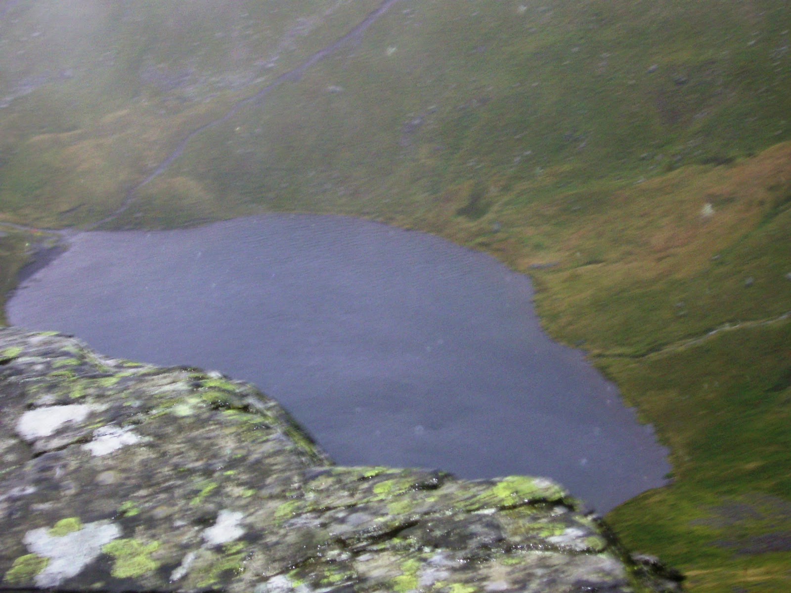
Turning right at the end of the shelf the path skirted the lower slopes of Scales Fell above the river Glenderamackin. Soon the path began the steep climb beside Scales Beck where it flowed down from the Tarn above. Sharp Edge was getting closer with every step. As the path levelled out at the top of the climb, Scales Tarn stretched out before me below the towering face of Sharp Edge and the rock wall below Blenchathra's Saddle.

I could really feel the wind as I stood beside the tarn looking up at the ridge. I was wondering at this point whether I should attempt Sharp Edge under these conditions. In the end I decided to continue along the path leading up to the start of the ridge and see what it was like up there. As I climbed the slope the wind nearly blew me off my feet on a couple of occasions, and made walking quite difficult. In the end I reached the rocks that marked the start of the Sharp Edge traverse, and to my surprise the wind didn't seem quite as bad there.

I remember taking off my my waterproof so it wouldn't flap around before climbing up onto the first section of the ridge. The rocks were wet which made them somewhat slippy and required great care negotiating them. Once I had got a little further along the ridge, my feelings of apprehension were replaced by that of exhilaration. Whilst still taking the utmost care, I was really enjoying being there up on the ridge. The view down to the tarn was spectacular.

I stopped to take some photographs, and as it started to rain sideways across the ridge, the top of Blencathra's saddle was no longer visible. Further along Sharp Edge, the ridge became more exposed as I got closer to the climb up Foul Crag at the end. The rain seemed to be getting worse, although Blencathra's plateau seemed to offer protection from the wind.


Soon I had reached the end of the ridge but there was still the steep slippy climb up Foul Crag to reach the saddle.

It was a hard climb up the crag involving a great deal of scrambling. The section of the climb in the photo above turned out to be too slippy for my boots to grip, so I had to retreat and go up another way just to the right of this shot. When I eventually finished the climb, I was up in the clouds and rain. The ridge below was no longer visible, and unfortunately there was no views to be seen as I walked across the saddle to the summit of Blencathra. I met two small groups of people at the summit who I talked with for a short time before heading down the zig zag path towards Scales Fell.
As I decended, I suddenly came out of the cloud and I could see down to valley level once again. I took the path down to Doddick Fell where the ridge of joined Scales Fell. It was a steep slippy descent before leveling out. There was a fantastic view down into Doddick Gill on the right hand side of the ridge. There was also a spectacular view back up to Blencathra above the Gill, although the top of the summit was still in cloud.

After the the ridge flattened out, it widened into a broad dome as it sloped down to the valley floor. The path then skirted the bottom of the slope above the fields of Doddick Farm. It had been an enjoyable and exhilarating walk, in spite of, and partly because, of the weather conditions. I was feeling quite tired by this point and looking forward to getting back to my car at Scales. However, there was, to my suprise, one last section of rock to negotiate. Just before the path crossed the stream of Scaley Beck, it droped down over some steep rocks which were saturated with the rain. I droped down and crossed the Beck before climbing the smaller rock on the other side. This required some difficult scrambling, quite unexpected at this stage of the walk! Having passed this section, I followed the path back to the small hamlet of Scales nestled under the slopes of Scales Fell. I arrived back at the car around 2.30 in the afternoon. It had been a great walk.


No comments:
Post a Comment